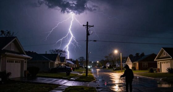

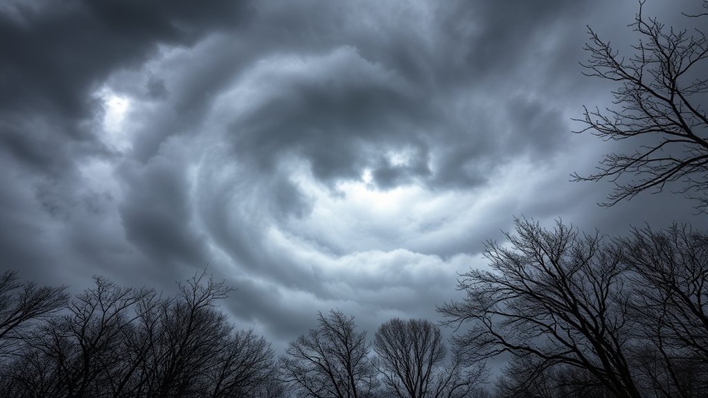
Northeast winds are the key to a nor’easter’s strength, driving heavy snow, strong gusts, and coastal flooding. These winds carry moist Atlantic air, fueling the storm’s severity and pushing risks inland. Powerful gusts over 70 mph can cause damage, power outages, and dangerous travel conditions. Tracking the storm’s low-pressure path and secondary lows helps predict wind extremes and impacts. Stay prepared for wind-driven snow and disruptions—you’ll uncover critical details for staying safe when these winds change everything.
Key Takeaways
- Northeast winds drive heavy moisture and cold air, intensifying snow and storm impact during a nor’easter.
- Gusts exceeding 70 mph can cause significant damage, power outages, and dangerous travel conditions.
- Tracking low-pressure paths helps predict wind strength and storm severity, essential for preparedness.
- Secondary low development can amplify wind gusts, leading to stronger storms and increased destruction.
- Securing outdoor items, preparing emergency supplies, and staying informed mitigate wind-driven damage risks.

Anker SOLIX C1000 Gen 2 Portable Power Station with 200W Solar Panel, 2,000W (Peak 3,000W) Solar Generator, Full Charge in 49 Min, 1,024Wh LiFePO4 Battery for Home Backup, Power Outages, and Camping
What You'll Get: Package 1 includes Anker SOLIX C1000 Gen 2 Portable Power Station, AC Charging Cable, Car...
As an affiliate, we earn on qualifying purchases.
The Significance of Northeast Winds in Nor’easters

Why are northeast winds so essential during a nor’easter? These winds bring in moist, warm air from the Atlantic and cold air from the Arctic, creating the perfect conditions for heavy precipitation and snow. Their direction helps steer the storm along the coast, intensifying its impact. Northeast winds also push moisture onto land, fueling blizzards and coastal flooding. When these winds are strong, they lift warm, humid air over colder surfaces, leading to heavy snowfall or rain, depending on the temperature. The position of the northeast quadrant maximizes snow accumulation by combining easterly moisture with cold air, making it critical for predicting storm severity. Without these winds, the storm’s ability to produce the typical heavy snow and fierce conditions diminishes markedly. Additionally, storm direction influences how the storm interacts with the local terrain, affecting the severity of impacts. Recognizing the importance of wind patterns can improve forecast accuracy and emergency preparedness during such events. Understanding the contrast ratio of the storm’s environment can also help meteorologists better anticipate the intensity and distribution of snow and rain. Moreover, atmospheric moisture transported by northeast winds significantly contributes to the storm’s overall strength and potential for heavy precipitation.

EF ECOFLOW Solar Generator Delta 3 with 220W Bifacial Solar Panel, 1024Wh Portable Power Station, LFP Battery 1800W AC/100W USB-C Output, Full Charge in 56 Min for Home Backup Power, Camping & RVs
Full Charge in 56 Min. With DELTA3's upgraded technology combining 500W solar input and 1500W max AC input,...
As an affiliate, we earn on qualifying purchases.
How Gusts Shape Storm Intensity and Impact

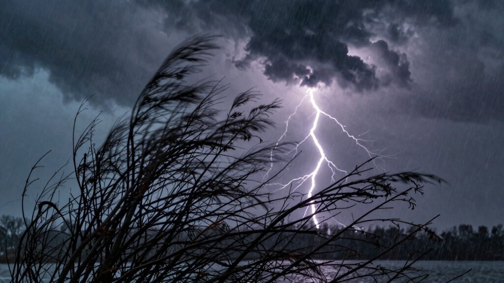
Gusts play a vital role in shaping the severity and impact of a nor’easter by delivering sudden, powerful bursts of wind that can cause widespread damage. These high-speed gusts, often exceeding 70 mph, can topple trees, damage structures, and knock out power. When gusts reach hurricane-force, they worsen storm conditions and complicate emergency responses. Strong gusts also contribute to coastal flooding by pushing water inland, especially in the northeast quadrant where moisture and cold air collide. Additionally, intense gusts can trigger blizzard conditions, reducing visibility and making travel dangerous. Tracking gust patterns helps you anticipate the storm’s potential for destruction and plan accordingly. Recognizing how these powerful bursts influence the storm’s impact allows you to better prepare for the chaos a nor’easter can unleash. Understanding the wind dynamics involved in these storms can improve forecasting accuracy and storm severity assessments, ultimately aiding in more effective preparedness efforts. Monitoring gust intensity and duration can provide early warnings and help mitigate risks associated with these extreme wind events. Furthermore, analyzing gust direction can help predict the storm’s progression and areas at greatest risk. Regular measurement of wind speeds during storms is essential for accurate storm impact evaluation and response planning.
Anker SOLIX C2000 Gen 2 Portable Power Station with 200W Solar Panel, 2,400W (Peak 4,000W) Solar Generator, Full Charge in 58 Min, 2048wh LiFePO4 Battery for Home Backup, Power Outages, and Camping
C2000 Gen 2 Portable Power Station and PS200 Solar Panel will be dispatched separately. Scan the QR code...
As an affiliate, we earn on qualifying purchases.
Tracking the Low Pressure Path for Accurate Forecasts
Tracking the path of the low-pressure system is essential for accurate storm forecasts because its trajectory determines where the most severe weather will hit. You need to monitor its movement northeastward along the coast, as deviations can mean the difference between heavy snow or rain. Key factors include the low’s interaction with secondary lows and the polar jet stream, which steer its course. By following these patterns, you can anticipate wind intensity, precipitation type, and location. Below is a table showing typical low-pressure paths:
| Path Type | Storm Impact Area | Likely Weather | Wind Direction | Snow vs. Rain |
|---|---|---|---|---|
| Coastal Track | Northeast coast | Heavy snow, wind | Northeast | Snow |
| Inland Track | Further inland | Less snow, rain | Variable | Rain |
| Offshore | Just off coast | Minimal impact | Calm | None |
| Southern Shift | Closer to Gulf | Rain, mild | Southerly | Rain |
| Northeastern Shift | Near Maritime | Heavy snow, gusts | Northeasterly | Snow |

Jackery HomePower 3000 Portable Power Station with 2X 200W Solar Panels, 3600W (Surge 7200W) Output, 3072Wh LFP Battery Solar Generator, Essential Backup for Home Use, Power Outage, RV, Emergencies
Essential Home Backup: With a robust 3600W output (7200W surge) and a 3072Wh capacity, the Jackery HomePower 3000...
As an affiliate, we earn on qualifying purchases.
The Role of Secondary Low Development in Wind Extremes
Secondary low development plays a crucial role in amplifying wind extremes during nor’easters, often producing the most intense gusts observed in these storms. When a secondary low forms in the Mid-Atlantic, it strengthens the overall storm structure and shifts wind patterns. As this low intensifies and moves northeast along the coast, it enhances pressure gradients, leading to stronger winds. These intense gusts, sometimes exceeding 100 mph, are especially common in the northeast quadrant of the storm, where cold air and moisture collide. Tracking the development and movement of these secondary lows helps you predict where the worst winds will hit. Understanding the types of piercings and their healing times can also be useful for storm preparedness, especially if you have body jewelry that might be affected by high winds or debris. Their formation is key to understanding sudden wind surges, power outages, and wind-driven damage during a nor’easter. Recognizing this process helps meteorologists forecast the storm’s most extreme impacts. Additionally, awareness of how storm intensity varies depending on secondary low development can improve preparedness and response efforts. Being aware of the pressure gradients involved can further refine wind impact predictions and safety measures. Moreover, understanding the storm evolution offers valuable insights into potential hazards and necessary precautions during severe weather events.
Preparing for Wind-Driven Snow and Power Disruptions
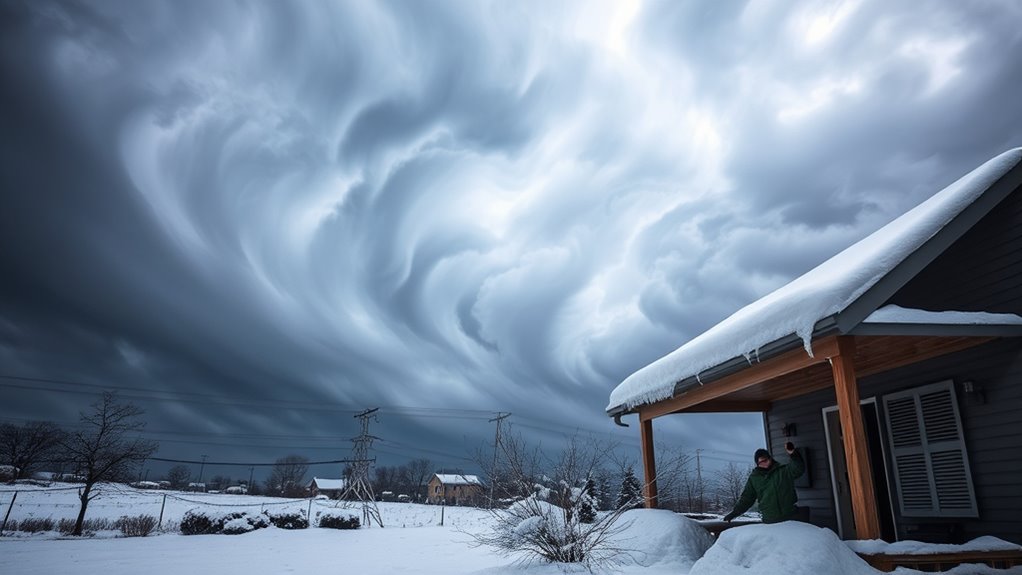
Strong wind gusts during a nor’easter can quickly lead to snowdrifts and power outages, especially in areas where the northeast quadrant directs moisture and cold air. To prepare, make certain your emergency kit includes warm clothing, blankets, and enough food and water for several days. Keep flashlights, batteries, and a charged power bank handy for outages. Trim tree branches near your home to prevent fallen limbs from causing damage or blocking power lines. If you rely on generators, test them beforehand and operate them outdoors in well-ventilated areas. Stay informed by monitoring weather updates and local alerts. Remember, gusts over 40-50 mph can cause significant disruptions, so plan accordingly—charge devices, secure outdoor items, and avoid unnecessary travel during the storm. Understanding wind impacts can help you better prepare for the challenges posed by high wind events. thermal behavior and how it affects structures during wind-driven snow can also enhance your preparedness. Being aware of building insulation and its role in maintaining warmth during power outages can further improve your readiness. Additionally, understanding HVAC optimization can assist in keeping your home warm efficiently when heating sources are limited. Recognizing storm surge dynamics is also crucial for coastal areas to avoid flooding and property damage during such events.
Frequently Asked Questions
How Do Wind Speeds at Mount Washington Compare to Other Storm Locations?
You’ll find that wind speeds at Mount Washington often surpass those at other storm locations, with gusts reaching up to 171 mph. This is because its elevation exposes it to lower-level jets and intense wind channels, making it one of the most wind-exposed places during storms. While other areas may experience strong winds, Mount Washington’s unique topography and elevation create more extreme gusts, making it a benchmark for storm wind strength.
What Atmospheric Conditions Cause Gusts to Reach Hurricane-Force?
Think of the atmosphere as a giant slingshot, launching gusts with incredible force. When cold, dense air clashes with warm, moist air, it creates a steep pressure gradient that fuels hurricane-force gusts. Strong jet streams and low-pressure systems amplify this effect, pushing winds to extreme speeds. If the winds are aligned with topographical features like ridges, they accelerate even more, releasing gusts that can shatter windows and topple trees.
How Can We Predict Secondary Low Development Early?
You can predict secondary low development early by closely monitoring the primary storm’s movement and temperature gradients. Keep an eye on satellite imagery and weather models for signs of secondary low formation in the Mid-Atlantic. Watch for increasing baroclinicity, moisture influx, and shifts in pressure patterns. Tracking these indicators helps you anticipate where and when the secondary low might develop, giving you vital time to prepare for intensified weather impacts.
What Are the Most Effective Ways to Prepare for Wind-Related Power Outages?
You should prepare for wind-related power outages by securing outdoor items, trimming trees near your home, and having emergency supplies ready. Keep flashlights, batteries, and chargers handy, and make sure your phone is charged before the storm hits. Stay informed through weather alerts, and consider backup power options like generators. Don’t wait until the last minute—being proactive helps you weather the storm without getting caught in the lurch.
How Do Wind Directions Influence Snowfall Distribution During a Nor’easter?
You can influence snowfall distribution during a nor’easter by paying attention to wind directions. Northeast winds bring in moisture and cold air, leading to heavy snow, especially in the northeast quadrant. Westerly or southerly winds tend to bring warmer air and rain, reducing snowfall. To stay safe, monitor weather updates, understand wind patterns, and prepare for heavy snow when northeast winds dominate, especially along the coast and in the mountains.
Conclusion
By understanding how northeast winds and gusts influence a nor’easter, you can better prepare for the storm’s power and surprises. Tracking the low pressure and secondary lows helps you stay ahead of the impact, whether it’s wind-driven snow or power outages. Are you ready to face the storm head-on? Being informed and prepared makes all the difference, turning uncertainty into confidence. Stay safe and weather the storm with knowledge on your side.